|
|
|
Revised New Series (colour) 1:50,000 maps
Surveyed 1842-1893 (New Series); revised 1893-1898 (Revised New Series); Coloured Edition published 1897-1904
In February 1804, some ten months before the publication of the first Old Series sheet, the Cornish engineer Richard Trevithick, in order to win a bet, built and successfully operated the first steam locomotive to run on rails. He was unable to capitalise on this achievement and it was left to others, notably George Stephenson, to refine and develop this new technology over the next 20 years. The result was a railway-building boom that was to transform the country.
Less than 100 miles of track existed in 1830; this had grown to 1,500 miles by 1840, and to 10,400 miles by 1860. The effect on the areas through which the railways passed was often dramatic, particularly around large junctions and termini: an estimated 4,000 houses, for example, were demolished during the building of St Pancras station in London. This revolution helped drive Britain’s increasing prosperity and industrialisation during the rest of the century, and contributed to numerous social changes including the growth of trade unionism, the advent of tourism and the standardisation of national time.
The railways also enabled goods and people to be quickly transported to and from large towns and cities, so hastening the existing trend towards urbanisation. In 1800, around 75% of the population had lived in the countryside and the rest in the towns; by 1880, these proportions had been reversed. As a result, many long-familiar aspects of the landscape were changing for good – and changing far more quickly than they could be mapped. Within a few decades of the first appearance of the one-inch Old Series, it had become clear that the process of surveying, revising and re-publishing maps of Britain was to be a never-ending task, the more so as the maps were increasingly being put to a wide range of civilian, as well as military, uses.
The government and the Ordnance Survey took several measures to address this issue. From the 1840s surveys were carried out at increasingly detailed scales and were used for many purposes including railway construction, geological survey and sanitary reform. In order to ensure complete and accurate coverage, the 1841 Survey Act had already given surveyors the right to ‘enter into and upon any land’ in the course of their duties. Having moved into new premises in Southampton after a fire in 1841 had destroyed their overcrowded Tower of London headquarters, the Ordnance Survey, armed with its new powers and instructions, began work on re-surveying the country. The results, published at the one-inch scale between 1876 and 1896, were later to be known as the New Series. These used the same Cassini projection and origin of Delamere as the earlier Old Series maps. Indeed, the first New Series sheets were little more than reprints of the northernmost Old Series sheets but with a new numbering system.
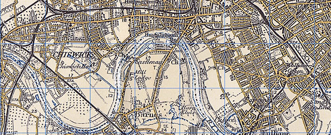
In 1893 a more thorough revision was undertaken which resulted in the publication of 346 sheets, between 1895 and 1899, of what became known as the Revised New Series (later sheets were merely the same with hachured hills added). Improvements in reproduction and printing techniques helped these to be even clearer and more accurate than their predecessors. By this time, however, another change was being demanded; for from the early 1890s, the military was pressing for a one-inch map in colour. Financial, technical, aesthetic and political considerations as to how this could best be accomplished were hotly debated between the numerous interested parties. In late 1896, the Ordnance Survey concluded that sales of the new maps to civilians would help subsidise the costs, a consideration which helped drive forward production of the first colour one-inch map the following year. Even then, the debate continued, and some features, such as the use of green for woodland (which only appeared on sheets 1 to 73, north of the Preston to Hull line), were amended as the series progressed. Although the final results were something of a compromise between the often incompatible aims of the military, the Treasury and the Ordnance Survey, the Revised New Series in colour stands as an elegant portrait of late-Victorian Britain. As the first coloured one-inch map series, it was also the precursor of Ordnance Survey’s 20th-century mapping which, from the Popular Edition onwards, would be increasingly determined by the demands not of the military but rather of the civilian market. The Revised New Series captures Britain at the height of its imperial prosperity. All but the very largest cities still had clearly defined boundaries, but with little of the urban sprawl that has since overtaken so much of the landscape. The construction of over 16,000 miles of railway track (of which about half survives today) had made its mark on the physical landscape, both by its very presence and through the social mobility that it helped encourage. Alongside and, increasingly, beneath these new developments, the maps still clearly show many of Britain’s more ancient features and settlements: but these are now dominated by the new Victorian urban society which in many ways forms the basis of our own.
|