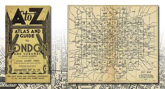
This publication shows street mapping of London as it was before the Second World War bombing and the redevelopments that followed and may be of assistance in tracing family history for that period. The coverage extends from central London to Edgware, Whetstone, Palmers Green, Edmonton, Walthamstow, Snaresbrook, Seven Kings, Barking, Silvertown, Plumstead, Kidbrooke, Bellingham, South Sydenham, Croydon, Streatham Common, Morden, Wimbledon Common, Twickenham, Richmond, Kew, Hanwell, Ealing Broadway, Wembley, Harrow and Wealdstone.
A foldout coloured Pictorial Map of Central London is attached to the inside back cover and this map features the locations of principal landmarks and places of interest using three dimensional drawings. The original printing of this paperback street atlas before the Second World War was in black only; however, this facsimile reproduction has been printed in colours which simulate the current condition after its ageing over many years. |