| |
 |
Choose your Free Cassini Map by |
| Sheet Number |
|
| or select your map by clicking on the correct square on the Grid Map |
| The Map is available for delivery in the UK only. £2.99 P&P charges will apply.
Only one map per visit, but you can visit as many times as you like. |

|
|
|
| Upgrade to a detailed, street level framed historical map of your home |
 |
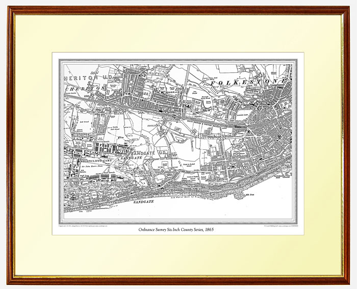
Ordnance Survey 1:10,000 County Series (first printed between 1880 - 1910).
A historical map centred on the location of your choice provided printed, mounted, framed and glazed - the perfect adornment to your home. |
|
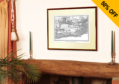
Beautiful framed map for just £34.99
saving 50% off the RRP |
 |
• Frame size 21.5” x 18” (55cm x 46cm) approx
• Mapping area 14” x 9.5” (36cm x 24cm) approx
• Each map covers an area of 9 x 6 miles (14.25 x 9.5 km) approx
• Scale 1:10,000
• Supplied in a pale ivory mount and teak-stained frame with gold trim and acrylic glass |
| Ordnance Survey’s County Series maps reveal the changing face of Britain in compelling and painstaking detail. Presented in a frame, Cassini maps make ideal gifts for you, your friends and family or anyone with an interest in the history of their area. |
|
|
Cassini Free Maps Terms & Conditions
By applying for the Map you agree to be bound by the following Terms and Conditions:
The free map (the “Map”) will be from one of Cassini Publishing Ltd’s (“Cassini’s”) three historical mapping series (Old Series, Revised New Series, Popular Edition) ("Map series") of large-format covered and folded historical sheet maps covering England, Wales and the Isle of Man. Applications are only available from www.cassinimaps.co.uk (the “Website”)
By making an application through the Website for a Map, you agree to receive the Map and to pay £2.99 for UK P&P. These P&P costs are zero-rated for VAT. Each Map is available at this price for delivery to the UK only. Higher P&P charges will apply for overseas delivery.
We estimate that your map will be despatched within 14 days of your application being accepted by our Website. Applicants must be resident in the UK and be over 18 years old.
The Map is available only while stocks last. Maps are offered on a first-come-first-served basis.
*Some areas have limited stock availability. If the Map of your selected area is not available you will be advised of this on the Website at the time of making your application in which case you may then choose a Map of a different area. Cassini reserves the right to change the Map Series offered for any area at any time depending on stock availability.
The Map is non-returnable and non-exchangeable.
P&P can only be refunded or the Map replaced if proof of damage in transit can be demonstrated.
Under DSRs, if you cancel your application after the Map has been dispatched, you will have to return the Map at your own risk and be liable for any postage and packing costs incurred in doing so, the P&P cost you paid will then be refunded if the Map is returned to whatever UK address we specify in a re-saleable condition.
P&P refund applications cannot be processed unless the Map is returned to us in a re-saleable condition together with your Cassini order number, name and address. Cassini will refund P&P charges if the map cannot be supplied for any reason after the application is accepted.
If for any reason you wish to contact us about any aspect of your order you must email customerservices@cassinimaps.com . No responsibility can be accepted by Cassini for any action that you take, including returning maps, unless you have so contacted us and we have replied within a reasonable period of time. If your enquiry concerns non-delivery, please note the despatch time mentioned above and please also re-confirm your delivery address. If you have ordered more than one Map, each one may arrive separately.
Cassini will deliver the Map to the address you specify at the time of making your application. No liability can be accepted by Cassini for non-deliveries as a result of incomplete or inaccurate address information being supplied.
The Map offer is available until either 100,000 applications have been received or until 31st March 2013 ("The Closing Date"). Cassini reserves the right to extend or reduce the number of applications available at any time.
Applications cannot be made after the Closing Date.
Only one application may be made per Website visit.
By making an application for a Map, you accept these Terms and Conditions and agree to be contacted by Cassini via e-mail with details of other offers, newsletters and promotions. You can opt out at any time by clicking the "Unsubscribe" link in the emails.
Cassini Publishing Ltd, Registered Address: 118 Southbank House, Black Prince Road, London, SE1 7SJ. Registered in the UK: No. 05502798. VAT No. GB 876 3063 06. www.cassinimaps.co.uk
|
|
Your Free Map will be selected from one of the following map series depending on availability.
Old Series Edition
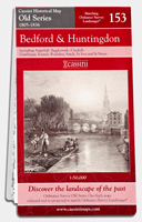 Britain’s 19th-century landscape re-projected and enlarged to match the present-day Ordnance Survey Landrangers®.
Created from Ordnance Survey Old Series Edition maps first published between 1805 and 1874
These maps were the result of the first ever national survey of England & Wales. From the late 1790s until 1874, a small army of surveyors covered every corner of the what was still an almost entirely rural country. Their work provided a stunning portrait of the landscape, with every farm, track, copse and hamlet recorded. Many of these features would have been unchanged for centuries, reminders of ancient patterns of settlement dating back to Saxon times. Britain’s 19th-century landscape re-projected and enlarged to match the present-day Ordnance Survey Landrangers®.
Created from Ordnance Survey Old Series Edition maps first published between 1805 and 1874
These maps were the result of the first ever national survey of England & Wales. From the late 1790s until 1874, a small army of surveyors covered every corner of the what was still an almost entirely rural country. Their work provided a stunning portrait of the landscape, with every farm, track, copse and hamlet recorded. Many of these features would have been unchanged for centuries, reminders of ancient patterns of settlement dating back to Saxon times.
Revised New Series (Colour)
 By the late 1890s, the Ordnance Survey had produced two complete series of maps of England & Wales but the increasingly rapid pace of change and development meant that revising them was now a never-ending task. The main cause of this change was the growth of the railways. From being little more than a good idea in 1830, the network covered over 18,000 miles by the end of the century, enabling the spread of goods, people and ideas and changing the character of every place it touched. The late 19th-century was without doubt the age of the railway, and the Revised New Series is the definitive record of its glory years. By the late 1890s, the Ordnance Survey had produced two complete series of maps of England & Wales but the increasingly rapid pace of change and development meant that revising them was now a never-ending task. The main cause of this change was the growth of the railways. From being little more than a good idea in 1830, the network covered over 18,000 miles by the end of the century, enabling the spread of goods, people and ideas and changing the character of every place it touched. The late 19th-century was without doubt the age of the railway, and the Revised New Series is the definitive record of its glory years.
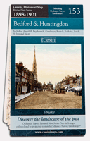
Popular Edition
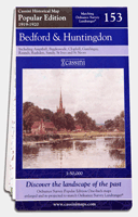 The original Ordnance Survey Popular Edition series was conceived before, but published just after, the First World War. This was the first of Ordnance Survey’s series to be conceived from the outset as a mass-market product, and the first to be produced in full colour. The new technology was put to the test in catering for a wholly new market. The original Ordnance Survey Popular Edition series was conceived before, but published just after, the First World War. This was the first of Ordnance Survey’s series to be conceived from the outset as a mass-market product, and the first to be produced in full colour. The new technology was put to the test in catering for a wholly new market.
If the railways were the transport revolution of the 19th century, the motor car was certainly that of the 20th. The new mapping series had to reflect this.For the first time the gradations of the road network were described, with each route being coloured according to its suitability or otherwise for motor traffic.
|
|