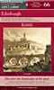
Scottish First Edition
 Although parts of Scotland were the first areas of Great Britain to be systematically surveyed, in the 1740s, it was not for over a century that work re-commenced on what was to become a complete survey of the country. The first maps of the Scottish First Edition appeared in 1856 and describe the a time of unprecedented social and demographic change. The Highland Clearances which followed the failed Jacobite uprising had led to large-scale migration to other parts of the country and overseas (principally Canada). In addition, the industrialisation of the lowlands was attracting workers from all over the country and beyond: Edinburgh’s population trebled during the 19th century, while that of Glasgow increased by a factor of ten. From the late 18th century, an agricultural revolution was also under way with many long-established smallholdings being absorbed into larger farms now being run for profit rather than for subsistence. These maps capture the Scottish landscape during this time of rapid transition from a feudal rural society to a sophisticated industrialised one, and display many features that these changes were soon to sweep away for good. Although parts of Scotland were the first areas of Great Britain to be systematically surveyed, in the 1740s, it was not for over a century that work re-commenced on what was to become a complete survey of the country. The first maps of the Scottish First Edition appeared in 1856 and describe the a time of unprecedented social and demographic change. The Highland Clearances which followed the failed Jacobite uprising had led to large-scale migration to other parts of the country and overseas (principally Canada). In addition, the industrialisation of the lowlands was attracting workers from all over the country and beyond: Edinburgh’s population trebled during the 19th century, while that of Glasgow increased by a factor of ten. From the late 18th century, an agricultural revolution was also under way with many long-established smallholdings being absorbed into larger farms now being run for profit rather than for subsistence. These maps capture the Scottish landscape during this time of rapid transition from a feudal rural society to a sophisticated industrialised one, and display many features that these changes were soon to sweep away for good.
The Cassini Scottish First Edition maps are ideal for anyone with an interest in the past. For local historians, they offer a consistent and accurate overview of your part of the country. For genealogists, they describe the landscape that your ancestors inhabited, as well as providing valuable research information about place names. Whatever your level of interest, these maps will take you on a fascinating journey back in time. Because we’ve enlarged the maps so they match the present-day OS Landrangers, it’s easy to make direct comparisons between then and now, letting you discover what has changed and what has not. Numerous features of the past still surround us, waiting to be re-discovered. These maps help point out the way.
|