London Street Map 1891
Created from original Stanford’s Library Atlas sheets showing Central London in 1891 at street-level
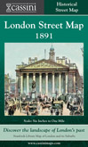 By the end of the 19th century, London was home to over five and a half million people, about 20% of the population of England and Wales. This map shows a metropolis that had over the preceding decades burst out of its centuries-old concentration around Westminster and the City. This Street Map covers the area Hyde Park
to the Isle of Dogs and from Highbury Fields to Brixton. London was now comfortably the largest city in the world and the capital of a vast empire with footholds in every continent. By the end of the 19th century, London was home to over five and a half million people, about 20% of the population of England and Wales. This map shows a metropolis that had over the preceding decades burst out of its centuries-old concentration around Westminster and the City. This Street Map covers the area Hyde Park
to the Isle of Dogs and from Highbury Fields to Brixton. London was now comfortably the largest city in the world and the capital of a vast empire with footholds in every continent.
One of the most eye-catching features of the map, however, is the railway network. The impact of the railways on the development of Britain in general and London in particular in the late 19th century can hardly be overstated. They are very clearly marked on the map, radiating out from the centre with loop lines creating a complex network in the inner and outer suburbs. They profoundly influenced the city’s patterns of development, enabling people to live beyond walking distance from their place of work and so allowing London to expand without chronic overcrowding.
Comparisons with other maps in this series and with the city of today show what has changed, but also what has stayed the same. The bird’s-eye view of central London’s railways and street plan is fascinating.
|