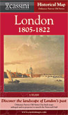
Old Series
Created from four Ordnance Survey Old Series maps first published between 1805 and 1822
 This map shows London as a metropolis of around 1.1 million people: tiny by today’s standards, but large enough to make it the world’s second most populous city after Peking. Apart from a built-up area from Lambeth to Rotherhithe, the city is all north of the river and hardly extends as far as today’s Circle line. Although ribbon development was starting to take place along the main routes leading out of London, places such as Wandsworth, Acton, Hampstead, West Ham and Streatham were quite distinct settlements, while numerous other parts of the present-day metropolis like Morden, Ealing, Finchley, Ilford and Sydenham were little more than villages, surrounded by fields and open countryside. Greenwich, Kingston, Richmond and Croydon were already sizeable towns on London’s outskirts. This map shows London as a metropolis of around 1.1 million people: tiny by today’s standards, but large enough to make it the world’s second most populous city after Peking. Apart from a built-up area from Lambeth to Rotherhithe, the city is all north of the river and hardly extends as far as today’s Circle line. Although ribbon development was starting to take place along the main routes leading out of London, places such as Wandsworth, Acton, Hampstead, West Ham and Streatham were quite distinct settlements, while numerous other parts of the present-day metropolis like Morden, Ealing, Finchley, Ilford and Sydenham were little more than villages, surrounded by fields and open countryside. Greenwich, Kingston, Richmond and Croydon were already sizeable towns on London’s outskirts.
The map describes a city that was already large but on the threshold of still greater expansion. Many of the mills, farms, parks, hamlets and houses that the map reveals were soon to swept away for good, although some survive as place names. Many of these had remained unchanged for centuries. Ordnance Survey’s early 19th-century surveyors captured numerous aspects of the human landscape just as they were about to be engulfed by the ever-encroaching metropolis.
This was the era of the horse-drawn cart, of the canal and the coaching inn, but also of slums, social inequality and untreated sewage. This map shows the London that had many ways had remained unaltered for generations but which was about to undergo a period of major expansion, development and social change. In 1821, the year before the last of the Old Series sheets used to create this map was published, the young Charles Dickens and his family moved from Kent to Camden Town. The London this map describes is thus the London of Dickens’ youth, the formative years of arguably the city’s greatest chronicler. The changes that London would undergo in Dickens’ lifetime would transform both the city and the surrounding countryside: before long, these changes would be felt all over the world.
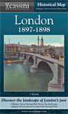
Revised New Series (Coloured Edition)
Created from eight Ordnance Survey Revised New (Coloured) maps first published between 1897 and 1898
 By the end of the 19th century, London was home to over five and a half million people, about 20% of the population of England and Wales. This map shows a metropolis that had over the preceding decades burst out of its centuries-old concentration around Westminster and the City to extend from Ealing to West Ham and from Tottenham to Croydon. London was now comfortably the largest city in the world and the capital of a vast empire with footholds in every continent. It was still growing, spreading itself out in every direction apart from the river-side marshlands of Kent and Essex, knotting together ancient villages and towns in a vast and uncontrolled urban sprawl. By the end of the 19th century, London was home to over five and a half million people, about 20% of the population of England and Wales. This map shows a metropolis that had over the preceding decades burst out of its centuries-old concentration around Westminster and the City to extend from Ealing to West Ham and from Tottenham to Croydon. London was now comfortably the largest city in the world and the capital of a vast empire with footholds in every continent. It was still growing, spreading itself out in every direction apart from the river-side marshlands of Kent and Essex, knotting together ancient villages and towns in a vast and uncontrolled urban sprawl.
The most eye-catching feature of the map, however, is the railway network. The impact of the railways on the development of Britain in general and London in particular in the late 19th century can hardly be overstated. They are very clearly marked on the map, radiating out from the centre with loop lines creating a complex network in the inner and outer suburbs. They profoundly influenced the city’s patterns of development, enabling people to live beyond walking distance from their place of work and so allowing London to expand without chronic overcrowding. Through the railways, the suburbs were born: the map helps show how this came about.
The late 19th century may have been the age of the railway engineer and the house builder, but open countryside still occupies the majority of the map’s area. Numerous farms cluster round the built-up region which provided ready markets for their produce, and as many villages still survived within a few miles of the city. Comparisons with other maps in this series and with the city of today show what has changed, but also what has stayed the same, The bird’s-eye view of central London’s railways and street plan is fascinating: so too is the far more ancient pattern of settlement that surrounds it.
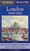
Popular Edition
Created from four Ordnance Survey Popular Edition maps first published in 1920
 By the early 1920s, London’s population was well over seven million, although a significant pattern was starting to emerge: despite this overall growth, the number of people in the city centre was declining as those who could afford it moved out to the fresh air and new houses of the suburbs. Many outlying areas such as Brentford, Hendon and Becontree saw astonishing population rises in this period. London was increasingly becoming a city of suburbs spreading out in every direction from its traditionally densely-populated centre. By the early 1920s, London’s population was well over seven million, although a significant pattern was starting to emerge: despite this overall growth, the number of people in the city centre was declining as those who could afford it moved out to the fresh air and new houses of the suburbs. Many outlying areas such as Brentford, Hendon and Becontree saw astonishing population rises in this period. London was increasingly becoming a city of suburbs spreading out in every direction from its traditionally densely-populated centre.
If the railways were the transport revolution of the 19th century, the motor car was certainly that of the 20th. After the First World War, Ordnance Survey for the first time produced a national mapping series designed from the outset to be in full colour. The new technology was put to the test in describing the gradations of the road network with each route being coloured according to its suitability or otherwise for motor traffic. Twenty times more vehicles were registered in the UK in 1929 compared to 20 years earlier, and many of those who could not afford (or did not dare) to use a car cycled instead. Increased leisure time and rising prosperity fuelled a demand for travel. As a result, accurate, relevant and up to date maps were needed. The Popular Edition provided them.
This map shows London on the threshold of yet another great change. The roads were threatening the railways, the suburbs were drawing people from the inner city. Beyond the built-up area, villages were turning into small towns, often with nearby parks and woods for recreation, while golf courses were in some areas starting to outnumber farms. Although still surrounded by open countryside containing many reminders of its past, London now totally dominated its immediate hinterland. This fascinating map captures the point at which the motor car began to define not only the landscape but also the way it which map-makers represented it.
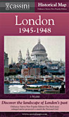
New Popular Edition
Created from four Ordnance Survey New Popular Edition maps first published between 1945 and 1946
 The London this map describes was one shaken by its war-time experiences, a city of rationing queues and bomb sites, and with around a third of its houses damaged or destroyed. Even more significantly, the evacuations (forcible or voluntary) had accelerated the existing pattern of movement out of the central area. The population of the borough of Stepney halved between 1939 and 1951, and inner London as a whole lost nearly a quarter of a million people in the same period. However, London as a whole – Greater London – had over 8.6 million inhabitants, more than at any time before or since. Major social and demographic forces were clearly at work. The London this map describes was one shaken by its war-time experiences, a city of rationing queues and bomb sites, and with around a third of its houses damaged or destroyed. Even more significantly, the evacuations (forcible or voluntary) had accelerated the existing pattern of movement out of the central area. The population of the borough of Stepney halved between 1939 and 1951, and inner London as a whole lost nearly a quarter of a million people in the same period. However, London as a whole – Greater London – had over 8.6 million inhabitants, more than at any time before or since. Major social and demographic forces were clearly at work.
This map reveals the reality of this outwards spread with great clarity. For the first time, the area covered by the series shows more built-up area than countryside, and in that respect is broadly similar to the city of today. The railways, though now at their maximum extent, are represented on this map far less prominently than are the roads, reflecting their reduced importance. Yet, nestled between the development, there are still plentiful reminders of the region’s more ancient past: numerous farms, orchards and copses are all clearly marked, though many of them have since been buried under layers of concrete and tarmac.
The New Popular Edition is a record of a battered London at the end of a global war and nearing the end of a period of global imperialism. If the Old Series describes the age of the horse and cart, the Revised New Colour that of the railways and the Popular Edition that of the dawn of the motor car, the New Popular Edition of the late 1940s is perhaps the map of the urban planner. Many schemes, some city-wide, some local, were proposed in the post-war years: some were implemented, others were not. The New Popular Edition elegantly captures the raw material which planners and developers were to use, for better or for worse, to create the London that we know today.
|