The 3-Map Box Sets form part of the Historical Map Gift Set. See below for more information. The Cassini Old Series maps are ideal for anyone with an interest in the past. For local historians, they offer a consistent and accurate overview of your part of the country. For genealogists, they describe the landscape that your ancestors inhabited, as well as providing valuable research information about place names. Whatever your level of interest, these maps will take you on a fascinating journey back in time. Because we’re enlarged the Old Series maps so they match the present-day OS Landrangers, it’s easy to make direct comparisons between then and now, letting you discover what has changed and what has not. Numerous features of the past still surround us, waiting to be re-discovered. These maps help point out the way.
Revised New Series
Another, quieter, technological revolution was also taking place at this time: the development of colour printing. Information could now be displayed in more subtle and varied ways, and at a reasonable cost. The government, the military and, increasingly, the public were demanding that the map-makers responded to this. After a new survey in the early 1890s, the Revised New Series (in colour) was published from 1896. This captured both the variety of the natural landscape and the human influence of Britain’s late-Victorian heyday in delicate shades of sepia, blue and ochre. The Revised New Series is an immaculate record of a vibrant society on the threshold of a still greater period of development and urbanisation. It records countless reminders of the past, many of which were about to be swept away for good. For local historians, this is the final record of your part of the country before the changes brought by the motor car. If your interest is genealogical, the series coincides with the 1901 Census, showing the landscape your ancestors inhabited. Whatever your reason for being interested in your area’s past, prepared to be entranced by these maps – enlarged and combined to match the present-day OS Landrangers, they will reveal secrets of a familiar landscape you never knew existed. Popular Edition
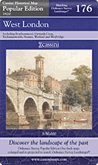
The original Ordnance Survey Popular Edition series was conceived before, but published just after, the First World War. This was the first of Ordnance Surveys series to be conceived from the outset as a mass-market product, and the first to be produced in full colour. The new technology was put to the test in catering for a wholly new market. If the railways were the transport revolution of the 19th century, the motor car was certainly that of the 20th. The new mapping series had to reflect this. For the first time the gradations of the road network were described, with each route being coloured according to its suitability or otherwise for motor traffic. Twenty times more vehicles were registered in the UK in 1929 compared to 20 years earlier, and many of those who could not afford (or did not dare) to use a car cycled instead. Increased leisure time and rising prosperity fuelled a demand for travel. As a result, accurate, relevant and up to date maps were needed. The Popular Edition provided them. This Popular Edition maps show England & Wales on the threshold great change. The roads were threatening the railways, the suburbs were drawing people from the inner cities. Beyond the built-up areas, villages were turning into small towns, often with nearby parks and woods for recreation, while golf courses were in some areas starting to outnumber farms. Although there was still much open countryside containing many reminders of its past, England & Wales was increasingly dominated by the large urban areas and the roads that connected them. High ground was now represented by contours rather than artistic hachuring; more accurate, less intrusive and more relevant to a society that was now less reliant on travel by horse and cart or on foot. This fascinating map captures the point at which the motor car began to define not only the landscape but also the way it which map-makers represented it. |
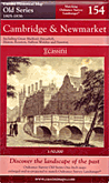 These maps were the result of the first ever national survey of England & Wales. From the late 1790s until 1874, a small army of surveyors covered every corner of the what was still an almost entirely rural country. Their work provided a stunning portrait of the landscape, with every farm, track, copse and hamlet recorded. Many of these features would have been unchanged for centuries, reminders of ancient patterns of settlement dating back to Saxon times. The maps elegantly capture the age of the canal, the coaching inn and the horse-drawn cart: the final decades of an agrarian society that was soon to be over-run by new transport links, rapid population growth and urban expansion.
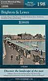 By the late 1890s, the Ordnance Survey had produced two complete series of maps of England & Wales but the increasingly rapid pace of change and development meant that revising them was now a never-ending task. The main cause of this change was the growth of the railways. From being little more than a good idea in 1830, the network covered over 18,000 miles by the end of the century, enabling the spread of goods, people and ideas and changing the character of every place it touched. The late 19th-century was without doubt the age of the railway, and the Revised New Series is the definitive record of its glory years.